


(Monument)
(County Line Rd)
(Greenland)
(Larkspur)
Mountain
(1)
Deer Ridge Way
(2)
Spruce Creek Rd
(3)
N. Firedog Way
(4)
Andiron Way

(5)
(Last Mod: 04 November 2010 18:39:32)
Getting to the house is actually quite easy -- it just doesn't seem like it.
The address is: (GPS: 39o 10' 13" N, 104o 56' 00" W)
13199 Andiron Way
Larkspur, CO 80118-6612
The first thing not to do is not to get off I-25 at Larkspur! The house is not in Larkspur nor even particularly close -- it is in unincorporated Douglas County. It is much closer to Palmer Lake. The mailing address is Larkspur only because that is where the post office that services the community is located (and, unfortunately, Palmer Lake is in El Paso County).
If you enter the address into your favorite GPS nav unit, you should be able to get there. My Garmin Nuvi took me straight to the house, although it took me the "back way" which is, perhaps, marginally shorter. However, it is also a bit more twisty and probably takes a little bit longer, but only marginally so (and it's a prettier drive!).
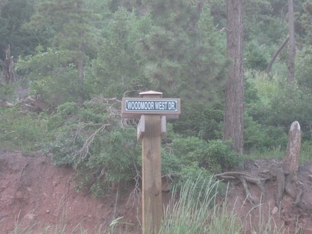
One thing to be aware of is that the road names seem to be a matter of quite a bit of disagreement. In the summer of 2009 they replaced all of the street signs and most of the names changed! Apparently the original signs did not agree with the official plat map and, supposedly, now they do. However, neither the old names or the new names completely match the names on the map generated by GoogleMaps or my Garmin -- and those two don't match each other. Bottom line: don't put too much faith in the street signs. Fortunately, there is very little opportunity to take a wrong turn.
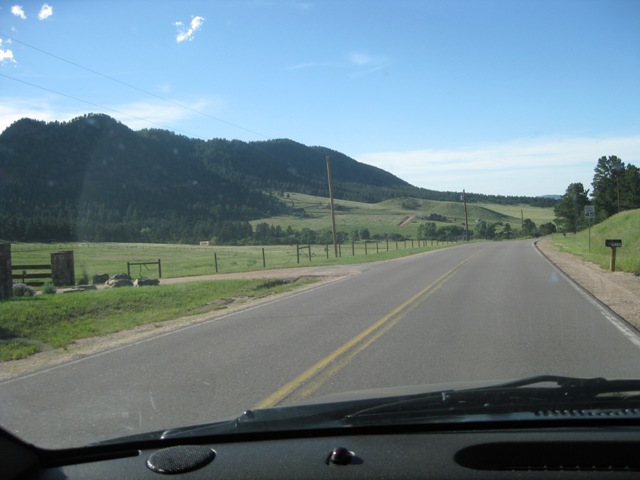
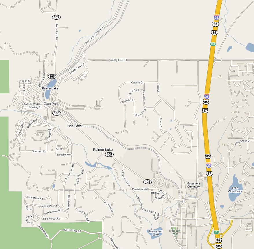
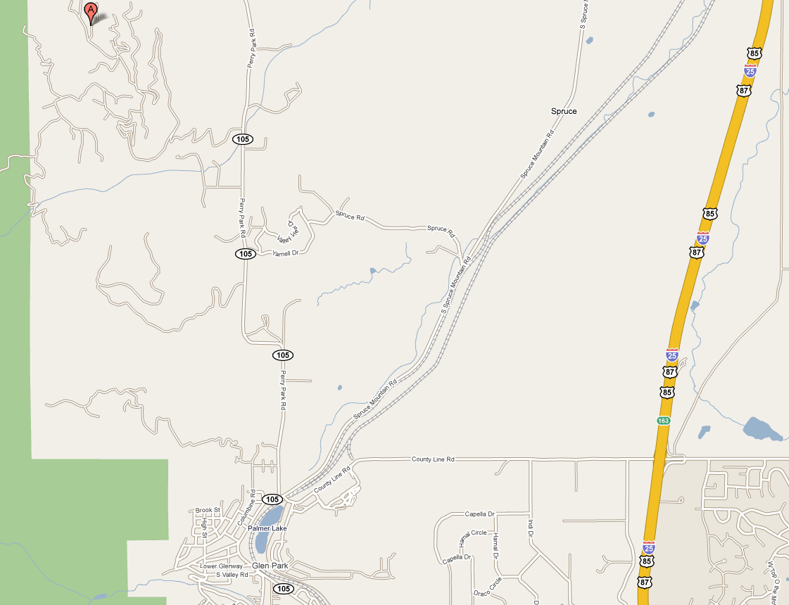
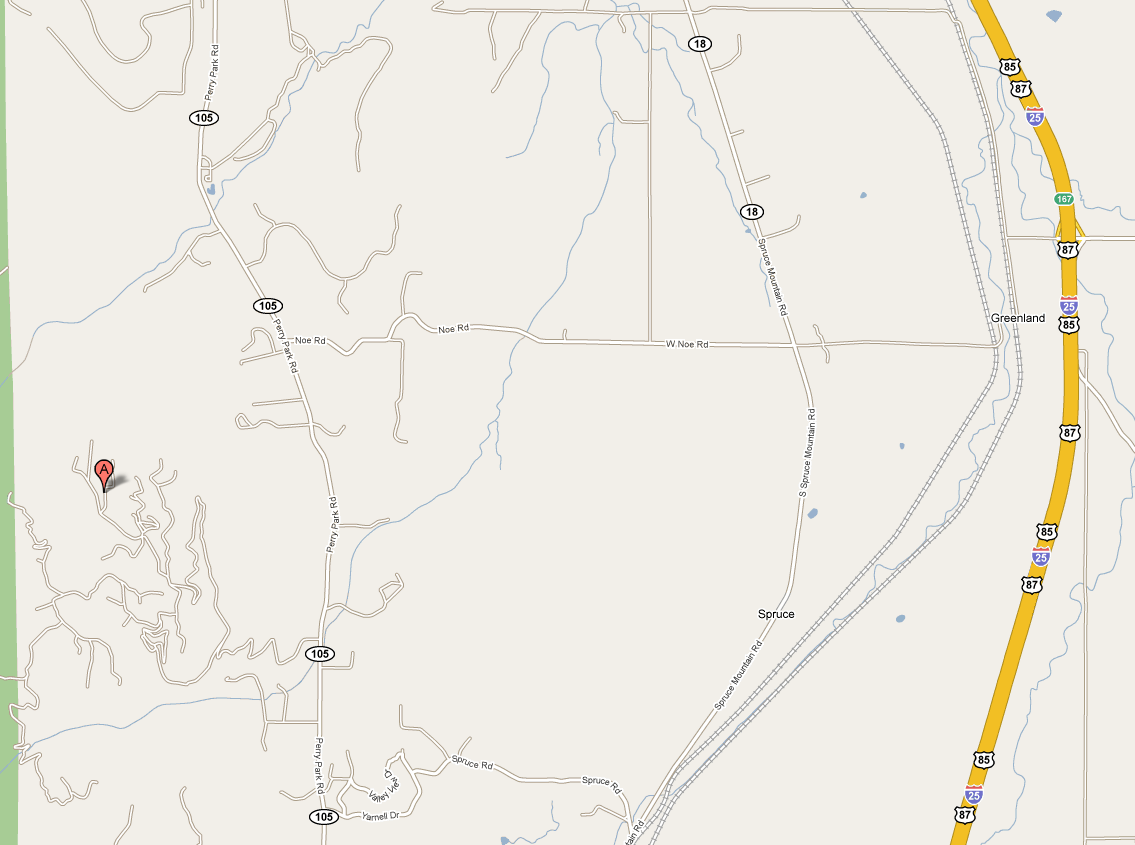
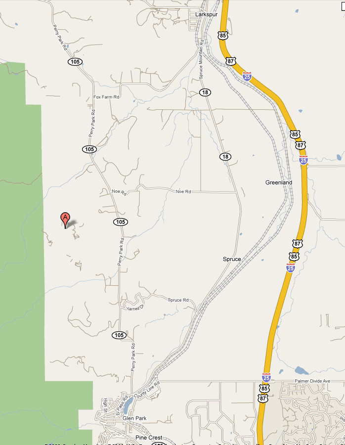
The first step in the process of getting to the house is to find the community, known as Woodmoor Mountain. It is located on the west side of Highway 105 about two miles north of Palmer Lake. Probably the simplest method of getting to Palmer Lake is to get off I-25 at Exit 163, which is County Line Road. Take this west for approximately two miles. Towards the end, the road will jog to the south and cross a set of railroad tracks. Just after crossing the tracks you will come to a stop sign at a T-intersection. You are now at the extreme northern edge of "downtown" Palmer Lake. Turn left and then take an immediate right onto County Hwy 105. At some point, this road becomes known as Perry Park Road.
Follow this road for approximately two miles. At the one mile point you will come to a sharp double dogleg that first curves to the left and then to the right. If you are coming from the north and reach this double dogleg, turn around! The entrance to Woodmoor Mountain is roughly 1.4 miles after coming out of the second dogleg.
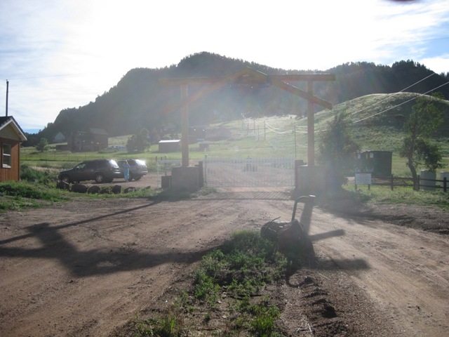
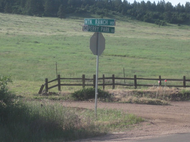
The Woodmoor Mountain entrance is both easy to spot and easy to run right past. If coming from the south, then roughly half a mile after coming out of the doglegs you will be able to see a dirt road on the west side going up toward the mountain that has several switchbacks -- this is the road you want to get onto. The entrance itself is masked behind a rather large stand of trees and private entrances to other properties -- the Woodmoor Mountain entrance is just beyond the stand of trees and it is the only road in the vicinity that has either a stop sign or a street sign. The road is named Mountain Ranch Road. It is a gated community (be sure to get the gate code from me before you come!) with a large log arch over the gate. In addition, there is a small mail house just south of the gate.
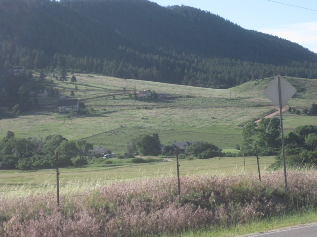
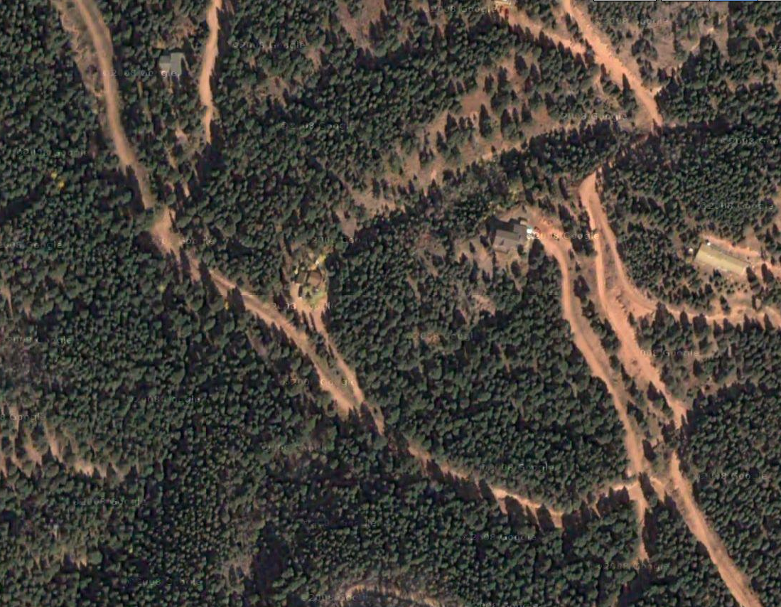
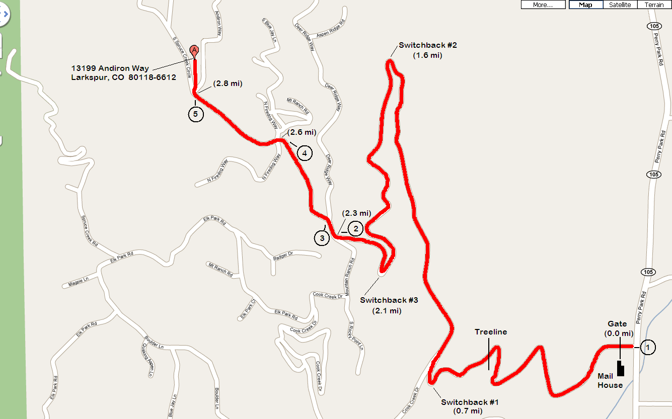
See the detailed map of the route from the gate to the house. The circled numbers refer to photographs taken at those points; the photos are in the bottom row of the table at the bottom of the page.
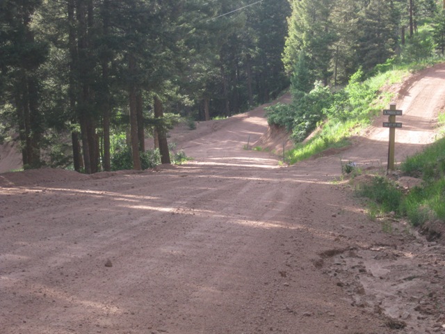
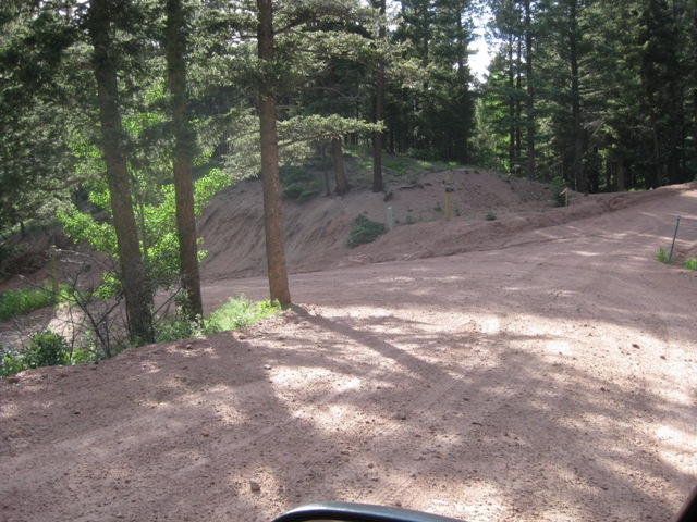
Once past the gate, just follow the main road approximately 2.3 miles until it ends in a T-intersection. As a sanity check to make sure you are still on the correct road, here is what to expect along this portion of the drive: Before you get into the trees, you will go through four switchbacks. Once into the trees, there will only be three more before you reach the end of the road. There are several driveways along the way, but none of them look too much like a road and so shouldn't cause any confusion. The only actual road is Cook Creek Drive just past the first switchback in the trees. It is a very sharp left turn, almost 180-degrees, combined with a private driveway that is next to a large, concrete retaining wall, so you shouldn't be too tempted to take it (although this is the route that my Garmin had me take, so it will work).
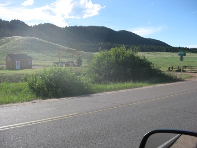
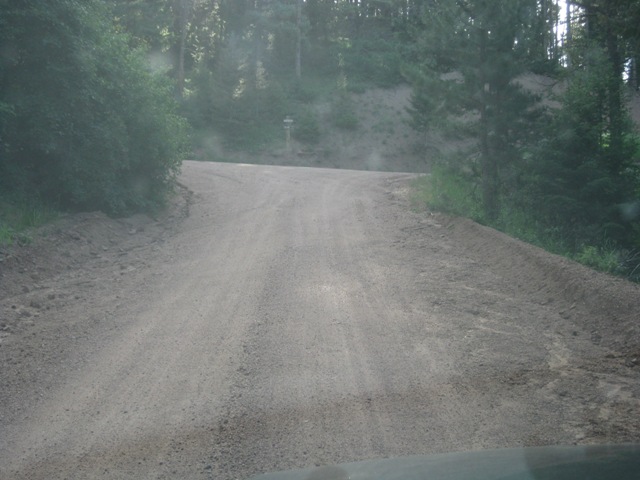
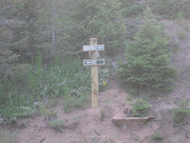
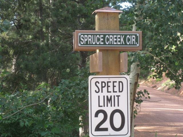
Once you get to the T-intersection you are only a half mile from the house and its all downhill, literally, from here. You want to turn right onto Deer Ridge Way (per the present signage). You might want to take note of the sign at this point and, in particular, notice that the "Exit" arrow points to the left and not back along the way you just came in. If you choose to follow it on your way out it will lead you through the back way and out via Cook Creek Drive. Not the end of the world, but if you can remember to turn left and go downhill back the way you came you will escape the mountain a few minutes quicker. Back to getting to the house -- after turning right onto Deer Ridge Way take an immediate left onto Spruce Creek Circle (again, per the present signage). Just after turning onto Spruce Creek Circle you will see a green sign mounted on a tree on the right stating that 4x4 or chains are required. Don't worry, the road ahead isn't (usually) any worse than the road you've survived up to this point even though, admittedly, it has a lower maintenance priority.
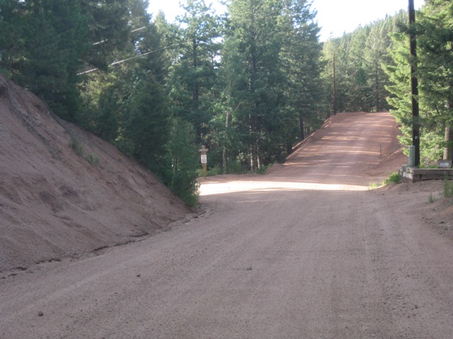
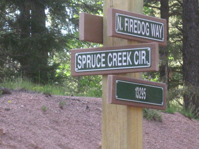
After about a quarter mile you will come what appears to be a multi-way intersection. In reality, what you have is a driveway angling off to the right just before Spruce Creek Circle takes a hard left and continues on downhill. What confuses things is that N. Firedog Way come in from the left at a shallow angle and crosses Spruce Creek at the curve and then heads off to the right along the same general line that Spruce Creek Circle would have had it simply gone straight. You want to stay on Spruce Creek Circle as it curves to the left and heads downhill; if you go straight you will be changing to N. Firedog Way. There is a sign at the intersection that makes this pretty clear. Just remember that, from the moment you turn at the T-intersection onto Deer Ridge Way, that you want to be going downhill.
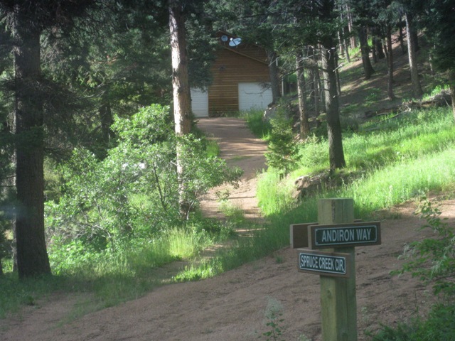
After you are past N. Firedog Way, simply proceed another quarter mile until you get to Andiron Way, passing one driveway on the right more or less halfway. The driveway to our house is located right in the corner at the intersection, so don't turn onto Andiron Way and start going up the hill.
|
|
|
|
|
|
|
|
|
|
|
|
| From Exit 161 (Monument) |
From Exit 163 (County Line Rd) |
From Exit 167 (Greenland) |
From Exit 173 (Larkspur) |
From Gate |
| Woodmoor Mountain (1) |
Approaching Deer Ridge Way (2) |
Approaching Spruce Creek Rd (3) |
Approaching N. Firedog Way (4) |
Approaching Andiron Way (5) |